


Global trade relies entirely on a few fragile geographic bottlenecks. The architecture of international commerce is built upon cargo volumes passing through narrow transit corridors. When these arteries function normally, the global supply chain operates with predictable efficiency, enabling corporations to optimize inventory cycles and reduce warehousing overhead. However, the operational reality of global trade is susceptible to physical disruptions that cannot be resolved through standard administrative procedures. When canals close due to drought or blockages, carriers cannot provide accurate updates for the thousands of stranded vessels. Recent events prove that a single grounded vessel in the Suez Canal or prolonged water drops in the Panama Canal instantly paralyze logistics networks.
During these bottleneck events, regional port authorities and ocean carriers are overwhelmed. They fail to deliver the precise location information required by corporate risk managers to protect stranded assets. The resulting information void leaves beneficial cargo owners entirely blind while their critical inventory sits uselessly in open water. Continuous Internet of Things tracking delivers the independent data required to manage massive delays and reroute effectively. Active, container-level digital monitoring establishes a direct line of sight to the physical cargo, bypassing the collapsed IT and communication networks of major ocean carriers. This technological independence provides the exact factual foundation required to maintain operational continuity during massive maritime bottlenecks.
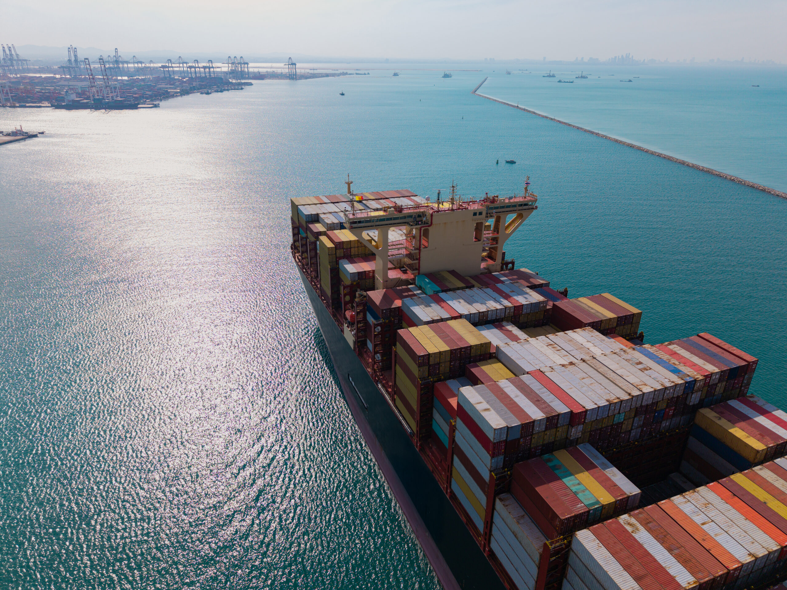
The Vulnerability of Global Chokepoints
The structural vulnerability of the global maritime network cannot be ignored by executive leadership. Critical international trade must strictly pass through geographically constrained chokepoints to successfully reach major North American and European consumer markets. Isolated events like droughts or grounded ships instantly freeze global trade. A regional environmental drought limiting vessel transits through the Panama Canal, or a loaded container ship physically running aground and blocking the Suez Canal, creates an unrecoverable logistical crisis. These commercial vessels carry thousands of individual shipping containers, representing billions of dollars in corporate inventory that is suddenly stationary.
The operational impact generates an expanding backlog of vessels trapped at anchor, waiting endlessly for clearance that may take several weeks. During these acute geographic crises, standard maritime schedules completely collapse, and any corporate reliance on projected estimated times of arrival becomes a financial liability. Carriers lose all actionable visibility as their regional IT management systems fail to account for the unprecedented scale of the vessel stack. To manage this exposure, global logistics directors require uninterrupted visibility when standard maritime schedules completely collapse. Deploying autonomous sensor technology directly onto shipping containers permanently provides this critical executive oversight.
Real-time location data is essential for knowing exactly where vessels are stacked. By continuously monitoring the exact global positioning coordinates of stranded physical assets, supply chain executives accurately assess the true physical severity of the maritime bottleneck. They determine if corporate cargo is positioned at the front of the queue or if it is helplessly trapped dozens of miles behind the primary structural blockage. This independent location intelligence allows corporate risk managers to isolate operational exposure, discard inaccurate carrier estimates, and formulate immediate financial recovery strategies based entirely on hard physical data.
Managing the Inland Logistics Domino Effect
A structural disruption at a global maritime chokepoint never remains confined to the open ocean environment. The immediate consequence of a stranded commercial vessel is the rapid collapse of synchronized regional transportation schedules across the destination continent.
Severe ocean delays destroy inland rail and heavy trucking schedules. Modern corporate supply chains operate on tightly synchronized intermodal transit transfers. When a vessel carrying critical import containers is unexpectedly stranded at a blocked geographic canal for consecutive weeks, the downstream logistical sequence experiences an unrecoverable domino effect. Heavy-duty commercial trucks dispatched to the destination port arrive to completely empty terminals, incurring severe waiting penalties. Scheduled freight trains depart without the required corporate cargo, completely breaking the planned distribution cycle. This physical misalignment immediately generates massive institutional financial penalties. If inland transport providers are legally forced to wait for delayed cargo, or if arriving containers cannot be immediately evacuated from a highly congested recovery port once the vessel finally docks, the beneficial cargo owner will face devastating operational fines.
Precise ETAs are critical to adjust regional logistics and avoid massive demurrage and detention fees. When supply chain directors have continuous access to active tracking data, they mathematically calculate exactly how long the cargo will remain stranded at the geographic bottleneck. Using precise delay data allows them to proactively reschedule rail and truck connections. This absolute data transparency allows the corporate logistics management team to quickly cancel premature inland transport orders, successfully negotiate revised loading schedules with regional rail operators, and mathematically ensure that expensive heavy trucking assets are only deployed at the exact moment the delayed ocean vessel formally secures a physical terminal berth.
Protecting Stranded Perishables and Sensitive Goods
The institutional financial risk associated with maritime bottlenecks extends far beyond schedule delays and inland transportation penalties. For global corporations transporting sensitive agricultural commodities, temperature-controlled biological pharmaceuticals, or delicate volatile chemical compounds, a stalled vessel represents a direct physical threat to the structural integrity of the product.
There is a high risk of reefer power loss and environmental damage when ships sit at anchor for weeks. Commercial container vessels trapped outside a blocked canal or forced to wait for drought restrictions to lift are pushed into periods of static anchorage. During prolonged delays, the vessel crew must aggressively manage onboard generator fuel consumption, which frequently leads to unpredictable power fluctuations across active refrigerated shipping containers. A sudden mechanical failure or an undetected electrical power loss within a specific corporate reefer unit will cause the internal container temperature to spike destructively. If sensitive cargo remains stationary in a hot climate for several weeks without regulated climate control, a shipment of advanced biopharmaceuticals or regulated food products will be destroyed before it clears the bottleneck.
Ensuring reefers do not fail while stranded at anchor is a critical operational mandate. Preventing this total corporate asset loss requires active climate monitoring to alert control centers before valuable cargo spoils. Independent environmental digital sensors deployed inside the sealed container constantly measure the internal micro-climate. If the internal temperature deviates from mandated legal safety parameters, the autonomous system immediately transmits an urgent digital alert to corporate risk managers.
This real-time independent intelligence allows the supply chain team to demand immediate physical intervention by the vessel engineering crew to restore electrical power, and definitively protect valuable corporate assets from total environmental destruction during the extended maritime delay.
Strategic Rerouting Decisions
When a major geographic global chokepoint entirely fails, executive supply chain boards are forced to make difficult operational choices. They must rapidly evaluate the physical severity of the bottleneck and definitively decide exactly how to mitigate the transcontinental delay. Deciding whether to wait out the blockage or execute a massive continental reroute is the primary challenge.
If a valuable vessel is trapped securely behind a grounded mega-ship in a narrow canal, the global logistics director must mathematically determine if it is more financially viable to leave the cargo stationary for an unknown duration, or order the ocean carrier to immediately discharge containers at an alternative regional port for an emergency transcontinental rail connection. These logistical pivots involve committing millions of dollars in emergency transportation capital, securing limited regional trucking capacity, and restructuring the downstream distribution network on short notice. Executing this level of corporate operational strategy based entirely on fragmented public news reports or vague carrier updates is financially irresponsible.
Hard, independent data is required to support high-stakes financial and logistical pivots. Active IoT tracking technology supplies the analytical digital foundation necessary to confidently make these critical executive decisions. By analyzing precise real-time location tracking data, the historical movement speed of the vessel prior to the stoppage, and the exact physical environmental condition of highly sensitive cargo, the executive risk management team accurately models the true financial cost of the static delay against the operational cost of an emergency reroute. If independent sensor data strictly indicates that the cargo will suffer irreparable environmental damage if left stationary at anchor, the high-stakes decision to violently reroute becomes an absolute financial necessity. Independent digital tracking formally transforms chaotic maritime disruptions into calculated, tightly managed corporate responses.
Conclusion
The operational financial stability of the modern global economy is permanently tied to the continued functionality of vulnerable geographic transit corridors. Assuming these narrow chokepoints will always remain clear is a dangerous failure of institutional corporate risk management. When environmental droughts critically limit canal transits or physical blockages entirely trap commercial vessels, standard logistical planning architectures catastrophically fail. Maritime bottlenecks demand absolute supply chain visibility. Strictly relying on delayed, vague carrier communications during a regional maritime crisis guarantees operational paralysis and severe corporate financial loss.
Implementing an entirely independent digital tracking infrastructure is the absolute definitive way to maintain complete executive control over physical assets during unexpected maritime disasters. Continuous digital monitoring directly delivers the physical location and strict environmental data required to perfectly manage cascading inland transportation delays, protect highly sensitive perishable commercial goods, and confidently execute high-stakes transcontinental rerouting strategies.
Navigate global chokepoints and protect your cargo with Contguard.
