


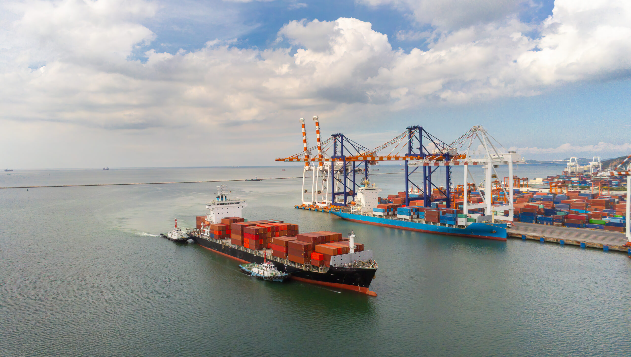

Historical transit data is now completely useless. Global maritime trade relies heavily on the predictability of established geographic chokepoints and tightly regulated transit corridors. The Suez Canal historically served as the primary, highly efficient artery connecting massive Asian manufacturing hubs with major European and North American consumer markets. The recent geopolitical destabilization and targeted hostility in the Red Sea region have completely severed this predictable logistical flow, forcing major international ocean carriers to execute unprecedented route diversions.
Rerouting massive cargo vessels around the Cape of Good Hope is not a minor operational adjustment; it is a fundamental disruption of the global supply chain that adds thousands of nautical miles and several unpredictable weeks of transit time to every single commercial shipment. Carriers are providing highly inaccurate ETAs for rerouted cargo, leaving supply chains blind. In standard logistics operations, a predictable, tightly managed schedule allows supply chain directors to run highly efficient, lean inventory models. In a state of chronic global disruption, relying on outdated maritime schedules or fragmented, delayed carrier updates inevitably leads to critical inventory stockouts and entirely broken regional distribution networks.
Passive tracking milestones, which only register a data point when a container is physically scanned at a major destination port, are entirely useless when a massive vessel is diverted mid-ocean for an extra three weeks. Independent IoT tracking provides the hard data needed to manage extended lead times. Active tracking delivers the precise geographic data and continuous digital visibility required to manage these severe route deviations. Supply chain leaders need definitive, mathematically precise proof of their cargo location to adjust downstream manufacturing operations, manage major retail customer expectations, and maintain strict business continuity during a prolonged geopolitical maritime crisis.
The Collapse of Predictive ETAs
The entire framework of modern supply chain planning is built strictly upon the concept of highly accurate predictive logistics analytics. Prior to the Red Sea crisis, supply chain software could accurately forecast port arrivals based on decades of highly consistent historical transit times through the Suez Canal. Historical data fails during major reroutes. The forced diversion around the entire African continent has rendered these massive historical data models completely obsolete and operationally useless.
Ocean carriers are actively struggling to process and provide accurate updates for their own fleets, frequently issuing revised arrival times that fluctuate wildly by weeks rather than days. Carriers are increasingly executing sudden blank sailings to manage their own severely disrupted capacity, leading to corporate containers being aggressively rolled or dropped at intermediate transshipment hubs without any prior notification to the beneficial cargo owner. Relying on these fundamentally flawed, carrier-generated estimates leaves corporate logistics teams operating in a constant, highly stressful state of reaction rather than proactive supply chain management.
When a regional distribution center expects a massive shipment of consumer electronics or industrial components on a specific calendar date, and the carrier silently pushes the arrival back by three weeks while the vessel is entirely unreachable at sea, the entire regional distribution strategy completely collapses. To regain control over these highly unpredictable schedules, supply chain directors must immediately abandon their reliance on carrier-provided estimates. Independent, real-time location tracking bypasses inaccurate carrier updates. Active tracking devices attached directly to the corporate shipping containers provide a continuous, unbroken stream of actual location data, completely independent of the ocean carrier reporting systems. This allows logistics teams to calculate their own internal, highly accurate arrival times based on the physical reality of the vessel position, enabling them to confidently adjust warehouse staffing schedules, coordinate inland freight transfers effectively, and mitigate the severe downstream financial impacts of the extended ocean voyage.
Preventing Manufacturing Stockouts
The immediate, highly destructive consequence of extended transoceanic lead times is the rapid, uncontrolled depletion of regional warehouse inventory. Decades of aggressive corporate supply chain optimization have pushed global manufacturers toward strict just-in-time inventory models, aggressively minimizing warehouse storage to reduce structural overhead costs and free up massive amounts of corporate working capital. Just-in-time inventory is incredibly fragile when lead times extend by weeks. If a major automotive manufacturing facility relies on a continuous, tightly scheduled flow of imported critical components, and those exact components are suddenly delayed by a full month due to an African route diversion, the factory floor will inevitably run out of raw materials and halt production completely. Preventing these catastrophic manufacturing stockouts requires supply chain directors to strategically manage and heavily deploy highly expensive emergency buffer stock.
Effectively managing buffer stock requires absolute, uncompromising certainty regarding all inbound ocean inventory. If a logistics director does not know exactly where their delayed maritime shipments are physically located, they cannot accurately determine exactly how much highly expensive emergency freight to authorize via international air cargo. Precise ETAs allow for calculated emergency air freight management. Knowing exactly when cargo will arrive allows logistics teams to optimize premium air freight spend. Continuous location tracking provides the exact primary data needed to make these high-stakes corporate financial decisions.
By knowing the precise geographic location and real-time movement speed of the delayed ocean freight, inventory managers can calculate exactly how long their current warehouse stock will physically last on the assembly line. This precise mathematical calculation allows them to order just enough emergency air freight to bridge the specific logistical gap, preventing a devastating factory shutdown while strictly controlling premium transportation costs and fiercely protecting the corporate bottom line.
Physical Risks of the Cape Route
Rerouting thousands of massive, heavily loaded container vessels around the southern tip of Africa introduces a completely new set of physical and operational risks to the physical cargo. The maritime environment surrounding the Cape of Good Hope is notoriously volatile and dangerous, characterized by severe weather and port congestion around Africa. Commercial vessels typically avoid these aggressive physical forces entirely by utilizing the sheltered, highly regulated waters of the Red Sea and the Mediterranean. This forced, prolonged exposure to severe oceanic forces places massive mechanical stress on the shipping containers and the highly sensitive internal cargo.
The extended transit time significantly increases the risk of severe cargo sweating, where extreme temperature fluctuations over a much longer voyage cause heavy condensation to form inside the steel container, entirely ruining sensitive electronics, pharmaceuticals, or agricultural commodities. In addition to the aggressive weather patterns, the sheer volume of diverted maritime traffic has completely overwhelmed regional African maritime infrastructure. Vessels attempting to stop for emergency refueling or unexpected mechanical maintenance are encountering massive terminal congestion and severe operational delays at ports that were never structurally designed to handle the primary volume of global east-west trade.
Monitoring cargo through this high-risk environment requires far more than simple location tracking; it demands continuous monitoring of the physical condition of the container itself. Active shock and climate sensors monitor cargo health during extended exposure. These sensors are specifically deployed to protect cargo from severe weather around the African cape. If a heavy storm off the coast of South Africa causes a container stack to shift violently, or if an unexpected port delay in Durban cuts power to a critical refrigerated unit, logistics directors need to know instantly.
Active environmental and shock sensors provide this exact critical data, alerting the corporate control center to any physical mishandling or internal micro-climate failures the exact moment they occur. This allows the supply chain team to proactively address the physical damage, arrange for immediate independent insurance inspections upon arrival, and absolutely prevent structurally compromised goods from entering the final retail distribution network.
Internal Corporate Reporting
A massive, prolonged supply chain disruption does not only affect the logistics and transportation department; it directly impacts the entire corporate financial structure. Sales teams cannot confirm major client retail orders, financial officers cannot accurately project quarterly revenue due to severely delayed cash conversion cycles, and major retail partners threaten massive financial penalties for breached delivery contracts. When a logistics director is forced to communicate these massive operational delays internally, simply stating that the cargo is delayed due to the Red Sea crisis is entirely insufficient. Executive boards and major institutional clients demand precise operational details and highly actionable recovery plans. Providing vague, constantly changing carrier updates only exacerbates the internal corporate panic and severely damages operational trust. Logistics directors need to provide accurate data to sales and finance teams. Independent tracking technology completely transforms this internal corporate reporting dynamic.
Instead of offering standard logistical excuses, supply chain directors can present internal stakeholders with an exact, live digital map showing the precise physical location of the diverted inventory and a highly accurate, strictly data-driven projection of the final terminal arrival date. Live digital maps and definitive proof of transit delays solve this visibility gap. This absolute data transparency allows the corporate sales team to manage major client expectations with hard factual data, enables the corporate finance department to adjust revenue recognition schedules accurately, and protects the corporation from severe legal and financial penalties by providing undeniable, mathematical proof of the transit delays. True global supply chain resilience requires total, uncompromised visibility across all internal corporate departments, permanently eliminating guesswork from executive decision-making.
Conclusion
The global supply chain has temporarily lost the predictable functionality of its most efficient maritime corridors. Modern corporate operations cannot rely on outdated historical averages or chronically delayed carrier updates to navigate this unprecedented level of systemic disruption. Geopolitical disruption requires absolute logistical visibility. Achieving this critical visibility means abandoning passive tracking methodologies and rapidly implementing independent, active data collection directly at the container level. Continuous tracking provides the exact location and environmental data needed to calculate highly accurate arrival times, manage critical buffer stock effectively, prevent devastating manufacturing halts, and ensure strict internal corporate transparency across all departments.
Regain control of your rerouted cargo with Contguard.
